Blog
All Blog Posts | Next Post | Previous Post

 What's new in TMS FNC Maps 1.5
Tuesday, May 18, 2021
We are back with another substantial update for TMS FNC Maps. 4 new components are introduced in TMS FNC Maps v1.5:
TTMSFNCStaticMap, TTMSFNCMapsImage, TTMSFNCTollCost and TTMSFNCTimeZone.
1. Static Maps & Map Image

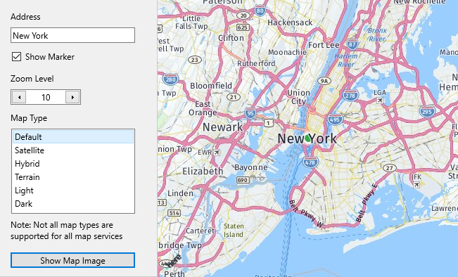
The new TTMSFNCStaticMap component lets you request a static map image for a specific location. The static image can be customized by setting the map type (roads, satellite …), zoom level and an optional marker at the center point. The resulting image can be displayed by using the TTMSFNCMapsImage component.
The following mapping services are supported: Azure, Bing, Google, Here, MapBox, TomTom
Only a single line of code is needed to request and display a static map image:
TMSFNCMapsImage1.URL := TMSFNCStaticMap1.GetStaticMap(CenterCoordinate,
    TMSFNCMapsImage1.Width, TMSFNCMapsImage1.Height, ZoomLevel, ShowMarkerBoolean, MapType);
2. Toll Cost calculation

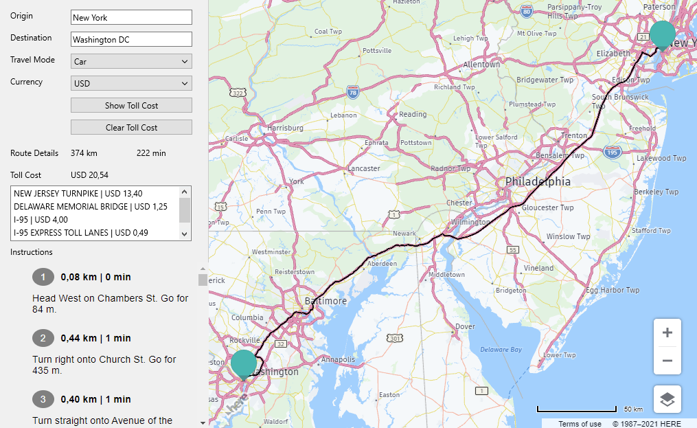
Using the TTMSFNCTollCost component the toll route costs between an origin and destination location can be calculated. Toll cost information is returned for each toll segment along the route together with turn by turn directions.
The following mapping services are supported: Here, PTV xServer
The toll cost calculation can be requested with just one line of code:
TMSFNCTollCost1.GetTollCost(OriginCoordinate, DestinationCoordinate);
3. TimeZone information

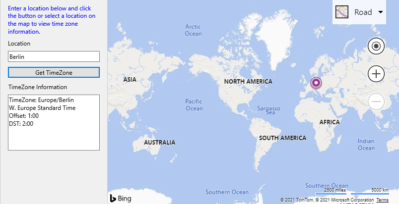
The TTMSFNCTimeZone component can be used to request time zone information for a specified location.
The following mapping services are supported: Azure, Bing, Google, Here
Again a minimum of code is needed to request and display time zone information:
procedure TForm1.TMSFNCMaps1MapClick(Sender: TObject;
  AEventData: TTMSFNCMapsEventData);
begin
  TMSFNCTimeZone1.GetTimeZone(AEventData.Coordinate.toRec)
end;
procedure TForm1.TMSFNCTimeZone1GetTimeZone(Sender: TObject;
  const ARequest: TTMSFNCTimeZoneRequest;
  const ARequestResult: TTMSFNCCloudBaseRequestResult);
var
  it: TTMSFNCTimeZoneItem;
begin
  it := ARequest.Items[0];
  memo.Lines.Clear;
  memo.Lines.Add('TimeZone: ' + it.TimeZone);
  meTimeZone.Lines.Add(it.Description);
  meTimeZone.Lines.Add('Offset: ' + it.Offset);
  meTimeZone.Lines.Add('DST: ' + it.DSTOffset);
end;
4. Minor improvements
Apart from all the new components, some improvements are also included with this update.
One of the noteworthy improvements is the possibility to retrieve the index of the waypoints in the optimized order for TTMSFNCDirections.
The following mapping services are supported: Azure, Google Maps, TomTom
That's it for this TMS FNC Maps v1.5 update. I hope you'll enjoy all these exciting new features!
Bart Holvoet

This blog post has not received any comments yet.
All Blog Posts | Next Post | Previous Post