Blog
All Blog Posts | Next Post | Previous Post

 Discover Polyline Helper Functions in TMS FNC Maps
Tuesday, July 30, 2024
When working with polylines in your mapping applications, having a set of helper functions can significantly enhance your productivity. In this article, we’ll explore a collection of useful calls that provide extra functionality for working with polylines using the TTMSFNCMaps component.
Splitting Polylines
Split(ACoordinate: TTMSFNCMapsCoordinateRec): TTMSFNCMapsPolyline
Split(AIndex: Integer): TTMSFNCMapsPolyline
The Split function allows you to divide a polyline at a specified coordinate or index. When you call Split(ACoordinate), it splits the polyline at the provided coordinate and returns a new polyline containing the segment after the split. Similarly, Split(AIndex) splits the polyline at the specified index and returns the resulting segment as a new polyline.
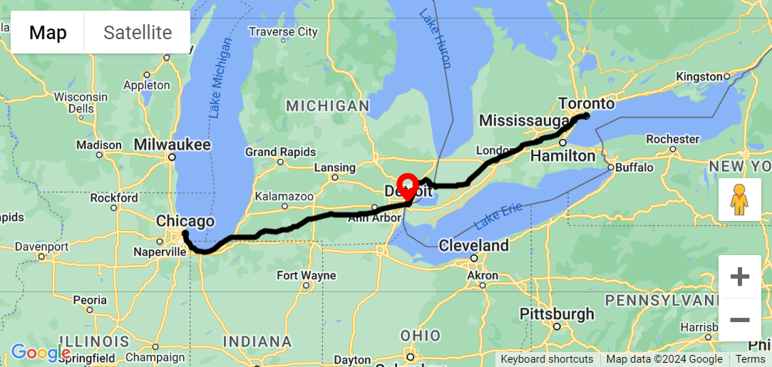
The black polyline displays a route from Chicago to Toronto passing through Detroit. A point near Detroit is selected on the polyline by a marker.
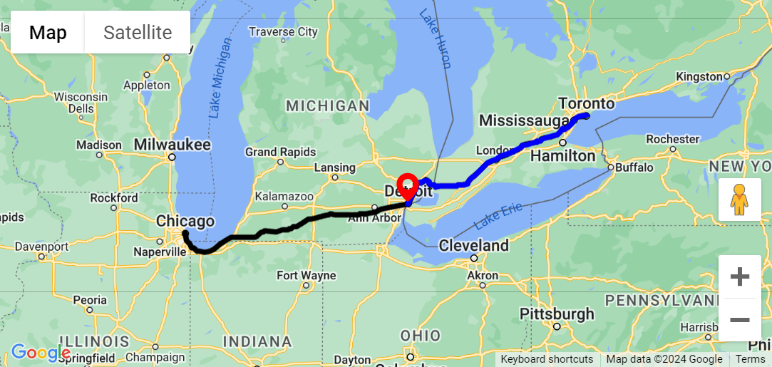
After splitting the polyline, the black polyline only goes up to the selected point. A new blue polyline is added which starts at the selected point.
Merging Polylines
Merge(APolyline: TTMSFNCMapsPolyline)
Merge(ACoordinates: TTMSFNCMapsCoordinateRecArray)
Merging polylines is essential when you need to combine multiple segments into a single polyline. The Merge function allows you to merge the original polyline with another polyline or an array of coordinates. When you call Merge(APolyline), the provided polyline is added after the last coordinate of the original polyline. Alternatively, Merge(ACoordinates) merges the polyline with the specified coordinate array.
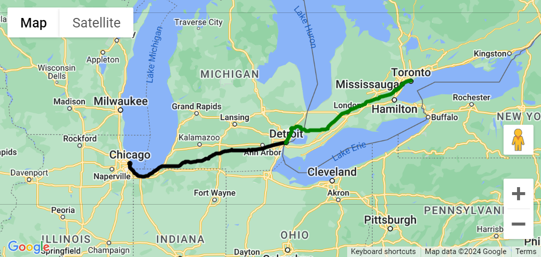
A black polyline displays the route between Chicago and Detroit. A green polyline displays the route between Detroit and Toronto.
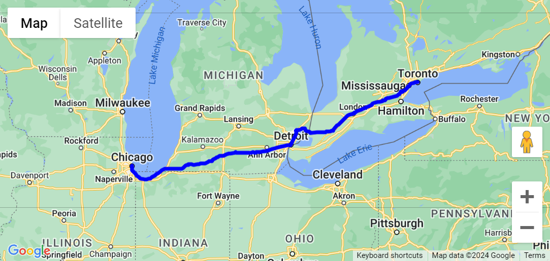
After merging both polylines, the blue polyline displays the route from Chicago to Toronto passing through Detroit.
Extracting Segments
Segment(AStartCoordinate, AEndCoordinate: TTMSFNCMapsCoordinateRec): TTMSFNCMapsPolyline
Segment(AStartIndex, AEndIndex: Integer): TTMSFNCMapsPolyline
The Segment function extracts a segment from the original polyline. You can specify the start and end coordinates or indices to define the segment you want. The resulting segment is returned as a new polyline.
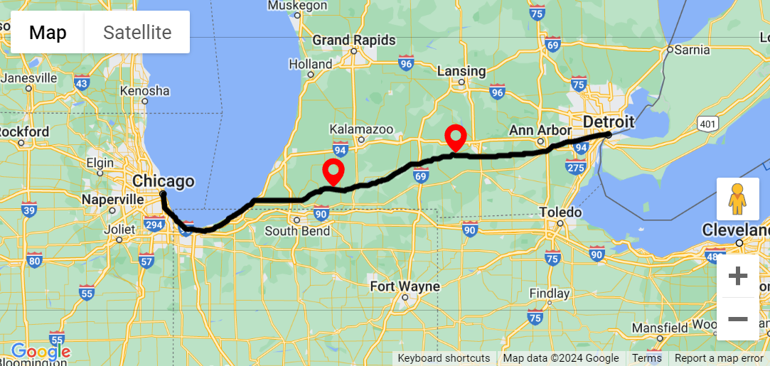
The black polyline displays a route from Chicago to Detroit with two points selected by a marker.
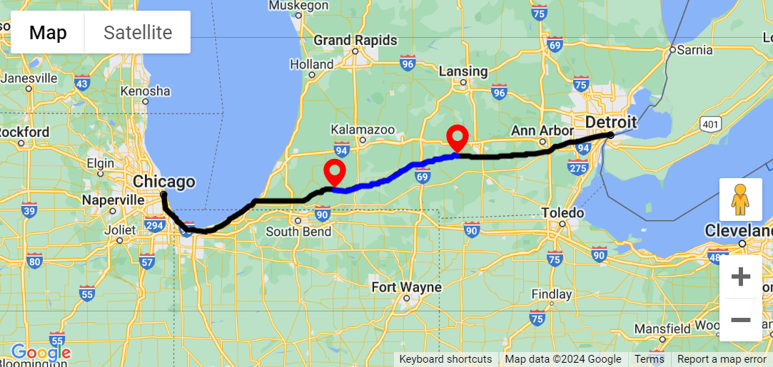
After extracting a segment, a new blue polyline is added that displays a route between the two previously selected points.
Finding the Nearest Coordinate
FindNearestPolylineCoordinate(ACoordinate: TTMSFNCMapsCoordinateRec; AMaxDistance: Double; var APolylineIndex: Integer; var ACoordinateIndex: Integer; var ACoordinateRec: TTMSFNCMapsCoordinateRec): Boolean
Sometimes, you need to find the nearest coordinate within a collection of polylines. The FindNearestPolylineCoordinate function does precisely that. You provide a coordinate, and the function searches for the nearest coordinate in the polylines collection. If a coordinate is found within the specified maximum distance (in meters), the function returns True. Additionally, it provides information about the polyline index, coordinate index, and the actual coordinate itself.
In the examples above this method was used to select the desired locations on the polyline. When a click occurs on the polyline, the OnPolyElementClick is triggered. The exact coordinate clicked is retrieved from the AEventData.Coordinate parameter. However, you want to know which coordinate in the polyline's coordinate array corresponds to the clicked point. This is where the FindNearestPolylineCoordinate call comes in. By using this function you can precisely determine the relevant coordinate within the polyline.
procedure TForm1.TMSFNCGoogleMaps1PolyElementClick(Sender: TObject;
  AEventData: TTMSFNCMapsEventData);
var
  c: TTMSFNCMapsCoordinateRec;
  m: TTMSFNCMapsMarker;
  PolylineIndex, CoordinateIndex: Integer;
begin
  TMSFNCMaps1.FindNearestPolylineCoordinate(AEventData.Coordinate.ToRec, -1, PolylineIndex, CoordinateIndex, c);
  m := TMSFNCGoogleMaps1.AddMarker(c);
  m.DefaultIcon.Enabled := True;
end;
Common Helper Functions
When working with TMS FNC Maps, you’ll find a wealth of common helper functions that simplify your development tasks. These functions provide essential utilities and streamline various operations.. Like MeasureDistance for example, to measure the distance between two coordinates.
Explore the TMS FNC Maps online documentation to unlock their full potential.
Explore the TMS FNC Maps online documentation to unlock their full potential.
Conclusion
These polyline helper functions simplify common tasks when working with polylines, making your mapping applications more efficient and user-friendly. Incorporate them into your projects to enhance your mapping experience!
Available Now
The TMS FNC Maps for Delphi update is available now. You can download the latest version and start using the new features right away!
Bart Holvoet

This blog post has not received any comments yet.
All Blog Posts | Next Post | Previous Post